

1. Approach’s Outline and Features
This approach aims to establish forest inventory methods while mapping the forest distribution and develop a forest GIS database as part of a National Forest Monitoring System (NFMS).
The first forest distribution map (as of 2015) was prepared as baseline information for the NFMS and a forest GIS database system containing it was designed and developed as a core engine of the NFMS. Using the analytical function of the forest GIS database, 640 random permanent field survey points were designed and prepared. Moreover, a field survey methodology, known as the National Forest Inventory (NFI) system, was developed by introducing Quality Assurance and the Quality Control (QA/QC) mechanism as well.
The NFMS/NFI system developed here can contribute to sustainable operation for managing national forest and range resources, which shall be updated every five years.
Keywords
NFI, NFMS, Forest Distribution Map, Forest GIS database, Survey methodology, QA/QC
2. Description of the project from which the approach is derived
2-1. Introduction
Botswana is working on REDD+ under the government’s Forest Policy 2011 and the 11th National Development Plan and there was an urgent need to develop a national forest monitoring system to enable science-based reporting. Thus, the Government of Botswana is working to establish a forest resource inventory to scientifically understand the status of its forest resources.
2-2. Details of the measures taken
- Firstly, a forest distribution map covering the entire forested and non-forested area in Botswana was prepared by interpreting LANDSAT images dating back to 2015 to identify the forest type distribution as a baseline for establishing a robust NFI system.
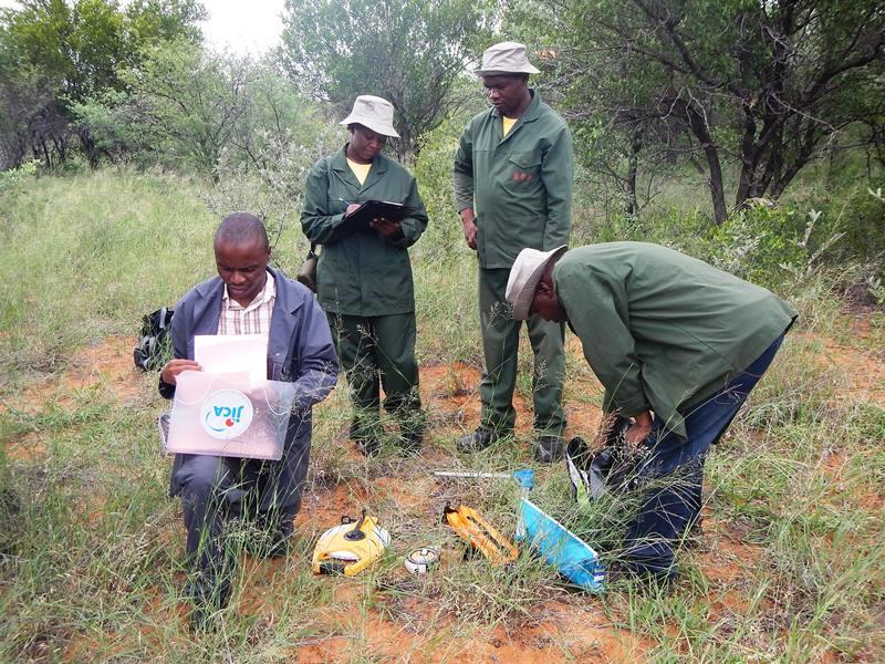
- Secondly, 640 permanent field survey points were selected on the forest distribution map using a GIS buffer analysis function so that they would be less affected by anthropogenic disturbances. Those points were then registered in a digital format (shape file) in the forest GIS database. Information such as the tree species, height and the volume acquired from each field survey point were stored as attribute data for those points and renewed every five years so that changes could be compared and understood and likewise the data over time in a five-year cycle.

- The abovementioned 640 survey points were randomly placed as NFI data by placing 4-km systematic grids on the forest distribution map overlapped with forest types (Riparian Forest, Typical Forest and Woodland).
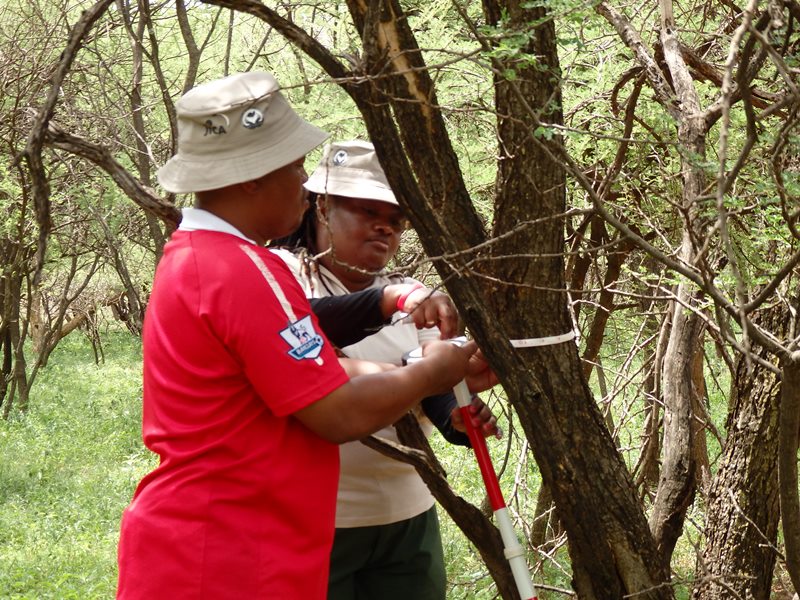
- As for the field survey methodology, the same practice as adopted in Japan, such as measuring breast height diameter (DBH), tree height and other data was applied. Moreover, maintenance of 200 different tree species codes for field book organization and methodology to reliably identify the survey unit location were transferred to all staff engaged.
- To minimize measurement errors by each team in the field survey, a cross-check survey was conducted by a separate team, which could contribute toward securing QA/QC.
(Perspectives on sustainability)
- The forest GIS database developed here which contains comparable NFI data every five years to secure QA/QC can ensure sustainable operation of the robust NFMS.
- The sustainability of the project was ensured by documenting all calculation processes and theories in detailed manuals so that the analytical and calculation methods for the data that was measured and collected would remain clear.
- At the end of the project, only about 400 of the 640 field survey sites were classed as complete, but by March 2021, once the JICA experts had withdrawn, the remaining 240 sites were completed by DFRR staff alone.
3. Analysis of the approach
3-1. Impact
- The Botswana Forest Distribution Map (BFDM2015), prepared for the NFI survey as of 2015, was the first externally and scientifically verifiable data prepared in Botswana and authorized by the Government of Botswana for reports submitted to the UNFCCC, FAO and other agencies.
- The above BFDM2015 will also have a significant impact in terms of helping formulate national forest and grassland resource policies, such as preparing and updating the national forest and grassland resource master plan, national development plan and so on.
- The forest GIS database developed here can be extended to a core system for the Botswana entire Government Management System in terms of connectivity between the head office and local offices.
3-2. Lessons learned
- Introducing a QA/QC mechanism for the NFI survey is important to ensure sustainable operation of the NFMS/NFI system, since that can directly help determine the accurate distribution of national forest and range resources.
- Leaving all the details of techniques in manuals from design to implementation stages is important to maintain a high level of motivation among the technical staff.
4. Relevant information
| NbS Approach Category | 2-1. 4 |
| Title of the project from which the approach is derived | Project for Strengthening National Forest Monitoring in Botswana |
| Country | Republic of Botswana |
| Biome | Savanna |
| Implementing term | 2013/July ‐ 2017/December |
| Implementing organizations | Department of Forestry and Range Resources (DFRR)/ Ministry of Environment, Natural Resources Conservation and Tourism (MENT) |
| Supporting organizations | Japan International Cooperation Agency (JICA), Oriental Consultants Global (OCG), Japan Forest Technology Association (JAFTA) |
| Report/Tool/Guideline | Forest Inventory Manual, GPS handling manual, True Pulse Manual, Forest GIS Data Base Operation Manual, FGISDB-PM, NFI Data Use Manual |
| Contributors to this article | Takashi Nanaumi /JAFTA |