

1. Approach’s Outline and features
This approach involves formulating a forest-monitoring system by synthesizing a forest stratification map and forest inventory data with a system involving time series analysis of maps and data on a sub-national level. While engaging in this approach, the staff having acquired the skills to interpret the satellite data, conduct the field survey and analyze the data, were able to formulate a forest distribution map capable of serving as basic information for REDD+.
Keywords
Forest distribution map, Survey methodology, Inventory database, Forest monitoring system, Off-JT and OJT
2. Description of the project from which the approach is derived
2-1. Introduction
In the Democratic Republic of the Congo, which has the second-largest tropical rainforest after the Amazon, large areas have been deforested due to human activities such as agricultural land development and illegal logging. However, forest inventories, which form the basis for forest management, are old and the technology and capacity required to build them, such as satellite image interpretation, are lacking. In response, the Japan International Cooperation Agency (JICA) has provided technical cooperation in ex-Bandundu Province[1] since 2012 to implement sustainable forest management practices using information obtained through forest mapping and implement national forest monitoring.
[1] From 2015, this province has been divided into three new provinces: Mai-Ndombe, Kwilu and Kwango.
2-2. Details of the measures taken
- Using ALOS, SPOT and LANDSAT satellite data, the forest cover status of the target area (former Bandundu Province) was interpreted and incorporated with ground survey results to formulate a forest distribution map as of 2010.
- Based on the forest distribution map, LANDSAT images of the target area in 1995, 2000 and 2014 were interpreted, time series changes were extracted and analyzed and a forest distribution map for each year was formulated.
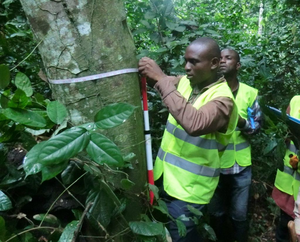
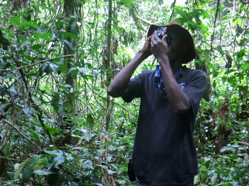
- Six inventory sites were established in the target area and a pre-inventory field survey was conducted. Based on the results, a forest inventory survey methodology was developed.
- Using the abovementioned survey methodology, a field survey of over 400 sampling plots established throughout the target area was conducted and five carbon pools were measured in the above- and below-ground portions of standing trees, dead trees, fallen trees and litter.
- Training was provided to the staff in biomass calculation using allometric equations with inventory data acquired from the abovementioned survey and the amount of carbon was calculated.
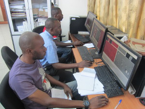
- Data obtained from the surveys were stored in a forest inventory database.
- A sub-national level forest monitoring system was established by linking the three components of formulating the forest distribution map, forest inventory ground survey and forest inventory database as a system.
- When implementing these tasks, off-JT and OJT (on-the-job training) were combined so that the staff involved in the work would acquire field survey techniques and gain data treatment skills.
(photo: JICA)
(Perspectives on sustainability)
For the government technical staff involved in this approach, their capacity to establish and operate forest monitoring system were improved through off-JT and OJT. In the future, it will be necessary to enhance their capacity not only to participate in forest inventory and remote sensing analysis work, but also to deal extensively with inventory methodology, budget preparation, schedule management, and quality control (QA/QC).
3. Analysis of the approach

3-1. Impact
As a result of the forest distribution mapping, forest inventory and database development conducted through this approach, the activity data and emission factor required to implement REDD+ were calculated and the forest reference emission level was established at the sub-national level.
Given the capacity development of staff of the Ministry of Environment and Sustainable Development through the pilot project in ex-Bandundu Province, they became aware of how to calculate the activity data and emission factor at national level also.
3-2. Lessons learned
During field surveys for forest division mapping and forest inventory, there is a need to be accompanied by a local administrative officer familiar with the local conditions to ensure the safety and efficiency of the survey, including coordination with village residents, information related to local access and avoidance of security risks.
4. Relevant information
| NbS Approach Category | 2-1. 3 |
| Title of the project from which the approach is derived | Project for Strengthening National Forest Resource Monitoring System for Promoting Sustainable Forest Management and REDD+ in Democratic Republic of the Congo |
| Country | Democratic Republic of the Congo |
| Biome | Tropical |
| Implementing term | 2012/5/15 – 2017/12/31 |
| Implementing organizations | Department of Forest Inventory/Ministry of Environment and Sustainable Development (DIAF) |
| Supporting organizations | Japan International Cooperation Agency (JICA), Japan Forest Technology Association (JAFTA) |
| Report/Tool/Guideline | Project Completion Report (English Summary), Projet rapport final (Covor – II Rapport Document annexe 3) (French), Projet rapport final (II Rapport Document annexe 4 – Forestiere de base) (French), Remote Sensing Analysis Manual, Forest Resource Inventory Technical Guideline and Manual, Forest Resource Data-Base Technical Guideline and Manual, Forest Reference Emission Level Technical Guideline and Manual |
| Contributors to this article | Osamu Mizushina /JAFTA |