

1. Approach’s Outline and Features
A model for monitoring logging concessions was formulated in accordance with a national forest resource monitoring system and in conjunction with the forest inventory.
The approach confirmed applying a logging concession monitoring system using a combination of medium- to high-resolution satellite data and drones would be an effective and efficient method of extracting changes in the target areas.
Keywords
Logging concession, National forest inventory, PDCA cycle, QA/QC, JJ-FAST
2. Description of the project from which the approach is derived
2-1. Introduction
Gabon, 80% of which is forested, is one of Africa’s leading timber exporting countries, but given risks of rapid deforestation due to overexploitation and other factors, conservation efforts are urgently needed. Accordingly, a national forest resource inventory system and a logging concession monitoring model were established to ascertain the current national status of forests and establish a model for sustainable forest resource management.
Previously, logging concession management was conducted by interviewing concessionaires in the field, then compiling and storing their records in paper form, which inevitably led to the loss of important data. Accordingly, it was decided to streamline this work by acquiring satellite data in the concession area and digitally archiving it.
2-2. Details of the measures taken
- This approach is based on the national forest resource inventory methodology and the national forest resource database and is intended to develop a model for a monitoring system for logging concessions to create to monitor forest resources appropriately.
- When developing a model for a logging concession monitoring system, key activities included 1) setting model sites, 2) using high- and medium-resolution satellite imagery and 3) verifying the effectiveness of the model.
- 1) Setting model sites
The site must be a forest area where a logging concession is established, covered by satellite data and where GIS data such as that of operation plans, etc. are available with the cooperation of the concessionaire. - 2) Using high- and medium-resolution satellite imagery
Since the logging was normally applied by selective cutting in Gabon, there was a need to use satellite images that would allow even a single tree cutting case to be identified. Using PALSAR-2* data (10 m ground resolution), some forest cover change induced from selective logging sites was identified in the field. The main road in the concession and some degree of open space at the selective cutting site were also identified. However, felling of single trees, roads narrower than around 5 m in width and open spaces less than 50 m or so in diameter could not be identified. Accordingly, the use of a drone was considered and its effectiveness was confirmed by combining it with the use of GPS data.
* PALSAR-2: The PALSAR-2 is a Synthetic Aperture Radar (SAR), which emits microwave and receives reflections from the ground to acquire information. Since it does not need other sources of light such as the sun, SAR has the advantage of providing satellite images, regardless of whether day or night. The frequency at which microwaves are transmitted and received is the L-band, which is less affected by clouds and rain. - 3) Verifying the effectiveness of the model
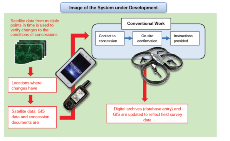
The model for the logging concession monitoring system was envisioned as shown in the figure below.
- 1) Setting model sites
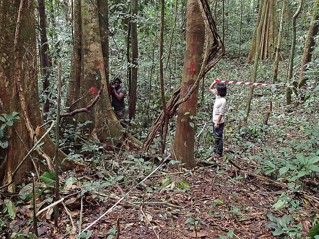
- The model should be able to identify single tree harvesting and observe areas that are distant from forest roads. The following procedure emerged as an efficient means of monitoring:
1. Identify the target area using PALSAR-2 data and specify the change points.
2. Import the target area coordinates into GPS based on PALSAR-2 imagery.
3. Raise the drone up to 500 meters from the closest point on the road to the target site.
4. Adjust the angle of the drone’s camera to a slant so that the drone can see a wide area.
5. Move the drone to a location where the target site can be confirmed, take photographs and return. - GIS data was also prepared and made available for review on tablet-type mobile terminals, GPS terminals, PCs and other equipment used in the field survey. It was also possible to archive the survey data as digital files using a field survey logbook in Microsoft Excel®.
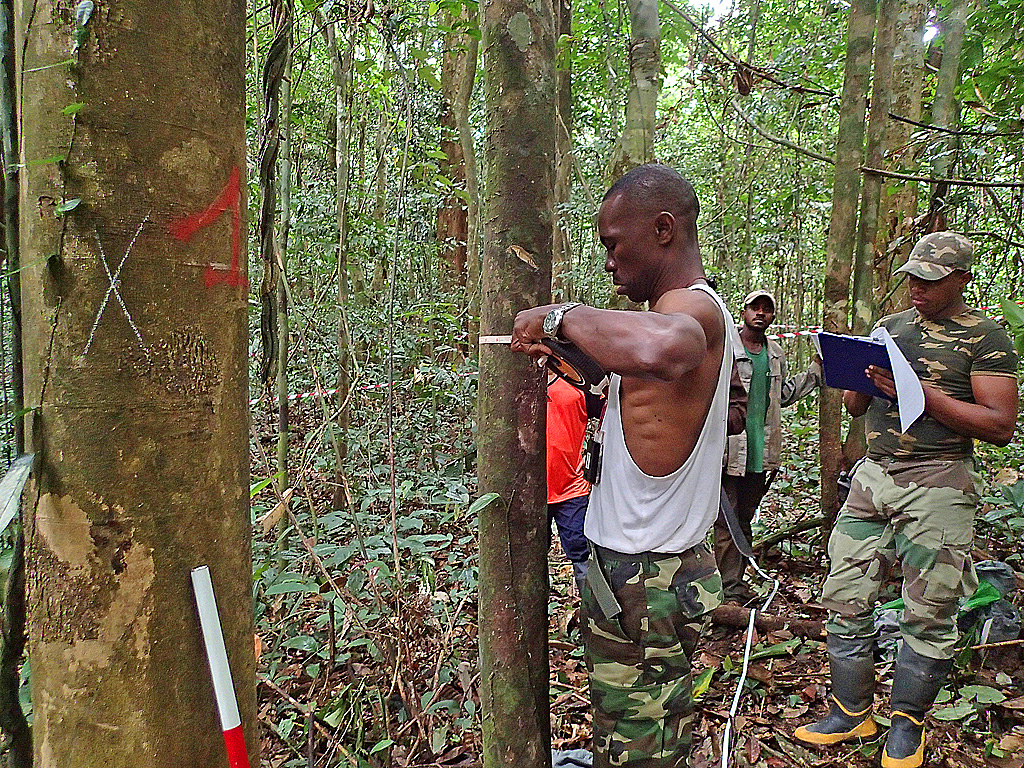
- These field survey procedures were compiled into the National Forest Resource Inventory Manual.
- To ensure the data remained accurate and ensure resource assessments would be conducted properly in future, corresponding methods for QA/QC (Quality Assurance/Quality Control) were specifically compiled in the manual.
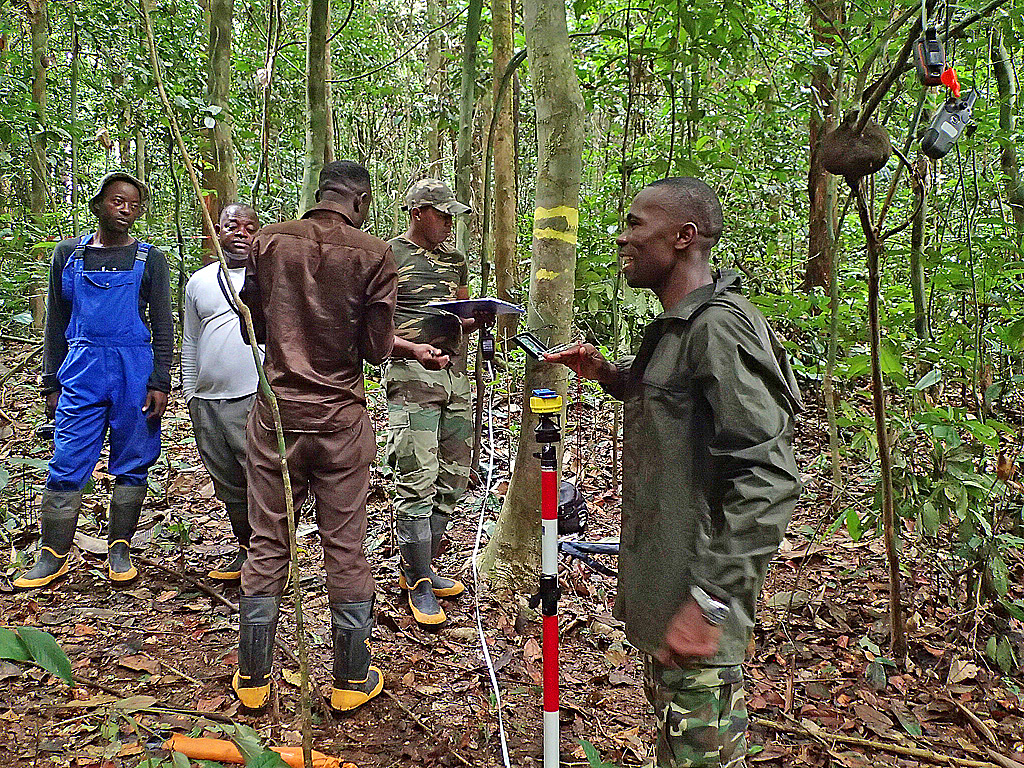
- Through on-the-job training, the technicians learned how to conduct field surveys by referencing satellite and GIS data transferred to Gyoroman’s GyoroMobile AD* in accordance with the developed field survey methodology.
* Gyoroman’s Gyoro Mobile AD
Gyoro Mobile AD is a mobile survey tool developed by Gyoroman CO., LTD, Japan. By installing a GIS application on a smartphone and inputting GPS data, this tool can accurately guide the user to the desired point in the forest. Photos and notes can also be recorded along with location information and used to conduct simple surveying.
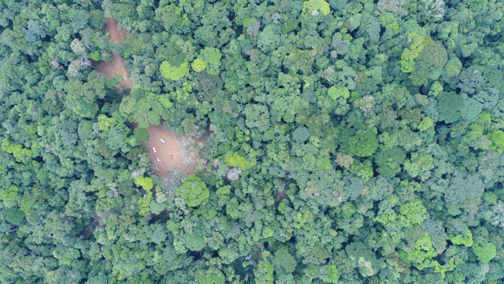
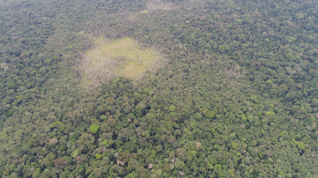
Below is the target area captured from the drone according to the procedure described above.
(Perspectives on sustainability)
- The data recorded in the field ledger by Microsoft Excel®, which was developed as a result of modelling the logging concession monitoring system, is expected to be stored electronically as part of the national forest inventory data. It is expected to dramatically improve the security, convenience and efficiency of storing and using the data obtained compared to conventional paper-based storage.
- Acquiring satellite data is important to operate the logging concession monitoring system sustainably. In that sense, collaboration with the space policy department, which has scope to receive and process data is important.
3. Analysis of the approach
3-1. Impact
- It was confirmed that a combination of medium- to high-resolution satellite data and drones could be used to identify target areas and single-tree felling sites by extracting changes and that an efficient and effective logging concession monitoring system has been established.
3-2. Lessons learned
- Since it is important to detect where logging has changed the forest in logging concession monitoring, utilizing the JICA-JAXA Tropical Forest Early Warning System (JJ-FAST) would be effective. JJ-FAST is JAXA’s web-based system of locating forest cover change based on PALSAR-2 data.
- For the system established in this approach to be positioned as a national forest resource inventory system and ensure continued budgetary action, there is a need to provide a legal basis, such as that stipulated in the Code Forestier (Forestry Code) for the system.
- Through the efforts of this approach for the forest policy department, effective results have been achieved through good relationships and collaboration with the departments handling climate change and space policy.
4. Relevant information
| NbS Approach Category | 2-1. 5 |
| Title of the project from which the approach is derived | Project for Strengthening the National Forest Resource Inventory System for Sustainable Forest Management |
| Country | Gabonese Republic |
| Biome | Tropical |
| Implementing term | 2012/8/19 – 2018/2/28 |
| Implementing organizations | Ministry of Water and Forests |
| Supporting organizations | Japan International Cooperation Agency (JICA), Japan Forest Technology Association (JAFTA) |
| Report/Tool/Guideline | Project Completion Report (English), National Forest Resource Inventory Manual, Land Cover Forest Type Map, Ground Truth Survey Manual |
| Contributors to this article | Yasuhisa Tanaka/JAFTA |